
PHOTOGRAPHS FROM THE EIGHTIES
This remarkable collection of twelve images was taken by Peter Hudson, a passenger on a railtour called the ‘Caerwent Cannonball’, which run on 15 March 1980, and which, amongst other places, visited the Big Pit washery at Furnace Sidings. Shortly after all the rails were lifted from the Top Line up to a little short of Blaenavon (High Level) station. We are very much hoping to prevail upon Peter to provide some more images if possible. These highly evocative pictures bring back a great deal of what we have lost in the past quarter of a century, and cry out for side by side comparisons with pictures from today. We will do what we can, so keep this page bookmarked.
We have tried to arrange the pictures in some kind of geographical sequence, with the sequence completed upon arrival at Furnace Sidings. We have added the captions, and trust that our memories are not TOO defective. We have not used the highest resolution images that Peter sent us in order to reduce the download times to something reasonable, but we do have very high resolution images to hand, and we MAY be able to help if you wish to scrutinize one in detail. Peter has given us approval to do with the images as we wish. If you DO decide to copy the images, then please respect his trust by not reproducing them, particularly for financial gain.
|
The train has just passed through Panteg & Griffithstown station, which saw its last passenger train in 1962. The up buildings still survive as the offices of a builders merchant Ron Couch. The train is now on Mon Bank having seen the route in the picture curve its way northwards through the complex of yards south of Pontypool Road station, to converge with the northbound Pontypool, Caerleon and Newport Railway, before entering Pontypool Road station proper. Panteg & Coedygric signal box has gone, the viaduct carrying the road has gone, though the road still exists carried on a series of embankment and single span concrete bridges, except for a short rump on the left which spans the PCN.. One of concrete bridges now spans the busy A4042 dual carriageway which crosses the space once occupied by the yards there. Even the gas holder disappeared in 2005. The line in the foreground is part of the route of the old Newport Abergavenny and Hereford Railway. |
|
The sad remains of Panteg and Coedygric signal box. It had closed only six months earlier. The train is on ‘Mon bank’ a steep portion of the old Monmouthshire Railway & Canal Company’s (the ‘Rat & Cat’s’) line south of Cwmynyscoy Viaduct and Skew Bridge which crossed the Mon and Brec Canal. Just beyond this point the line converged with the old Newport Abergavenny and Hereford Railway. The stone wall to the left of the box is the parapet of a very short tunnel that permitted the Taff Vale Extension Extension (sic!) to gain access to the Pontypool Caerleon and Newport, whilst to the right can be seen a small part of Panteg Steelworks. |
|
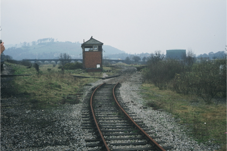
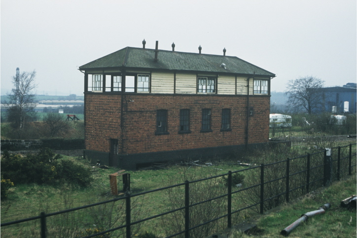
The train is passing a point where lines, remodelled around 1950 to form a double junction, permitted trains on the ‘Mon’ to drop down to the Vale of Neath line. Previously a complex tangle of short lines led down, albeit with some reversing, to Glyn Pits. Just round the bend lies Pontypool (Blaendare Road) Halt which was opened in 1928 and closed in 1962, and was used mainly by boys of the erstwhile Jones’ West Mon Grammar School. To the right of the train lies Trosnant Junction Signal Box, a curious box, which was raised bodily by three feet in 1933 so that it could additionally serve Pontypool (Clarence Street) in the Vale of Neath line below so that the box there could be closed. It was itself closed in November1968. Note the splitting home signal, faintly seen, just beyond the end of the train, which is an important clue to the location. |
|
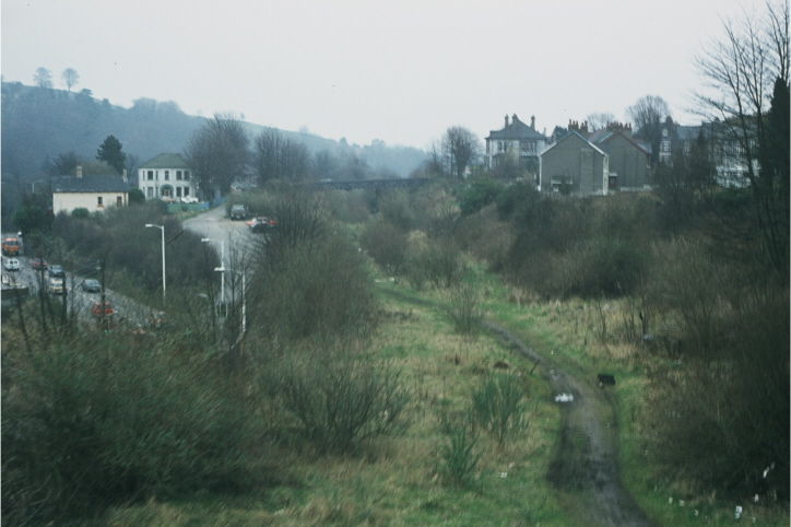
This view, to the south east, was taken from the train as it passed over the bridge at Trosnant Junction. The meandering path was once the bed of the Taff Vale Extension of the Vale of Neath line. Pontypool (Clarence Street) station occupied this area up as far as the footbridge in the distance, but the line was closed in June 1964. The area is now completely covered by the A472 dual carriageway, the successor to the road on the extreme left, which still functions as a local route. As for the bridge on which the train is standing, this has now been replaced by a slender modern structure which permits pupils of West Mon Comprehensive to make their way to and from school without tangling with the ceaseless road traffic |
|
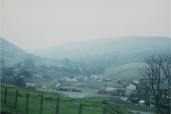
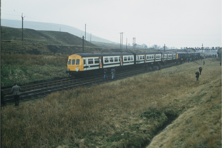
Looking from the train north west into the Cwmnantddu. The train is below Cwmffrwdoer Halt and the Plasycoed and Pantygasseg road overbridge, but a little above the site of Gwenallt signal box, which was closed in 1963. The Bridgend Hotel, which is still pulls pints, no longer proclaims ‘Rhymney Beers’ from its roof. The road in the foreground is rather lower than in earlier years, since it once climbed to span a line coming up from Pontnewynydd, by means of an overbridge. Immediately beyond the bridge stood the prosaically named Branches Fork Junction and its signal box from which the Ffrwdoer branch diverged to Gellideg, and to Tirpentwys colliery (off the picture to the left), and the Cwmnantddu branch diverged to the right before going forward into the valley shown. The construction site in the centre of the picture was once occupied by Gwenallt Colliery (locally known as the Jack Pit). Behind the Bridgend the Oak Brickworks once stood, which in latter years exclusively produced glazed earthenware pipes. |
|
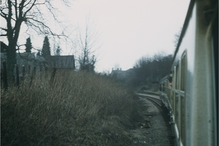
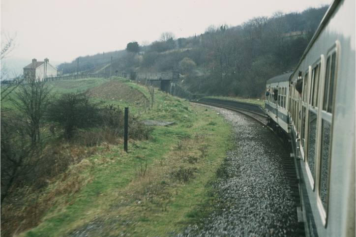
Heads out of train windows normally look in the direction of travel – if for no other reason than to avoid losing it on an otherwise unseen bridge parapet! This view is therefore on the return journey, going down, and facing south east. The train is about to enter the remains of Cwmffrwdoer Halt. The road overbridge carrries the road to Plasycoed and Pantygasseg, which is to the right and up a long steep hill. The line here was once double track, but was singled in June 1965. The halt, along with all others on the line was opened in 1928, but closed, doubtless due to the exigencies of war, on 5 May 1941 |
|
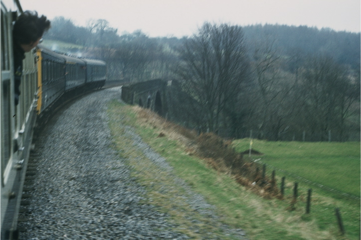
The train is on the ‘up’ journey is, judging by both heads and the exhaust. It is on the horseshoe bend between Cwmffrwdoer and Pentrepiod Halts, and is about to cross the impressive 66 yard Cwmnantddu Viaduct. Below it is a single track which once went both to Graigddu Brickworks, and a washery serving both Llanerch and Blaenserchan collieries (to the left of the picture). The line to the collieries was blocked by a landslide in 1932, and further landslides from the Llanerch tips in the early forties ensured that it would never open again. The line to Graigddu Brickworks was finally closed in March 1962, despite the brickworks having closed eleven years earlier. The brickwork’s minor claim to fame was that it was a major supplier of bricks for the brick arches of GWR locomotives. |
|
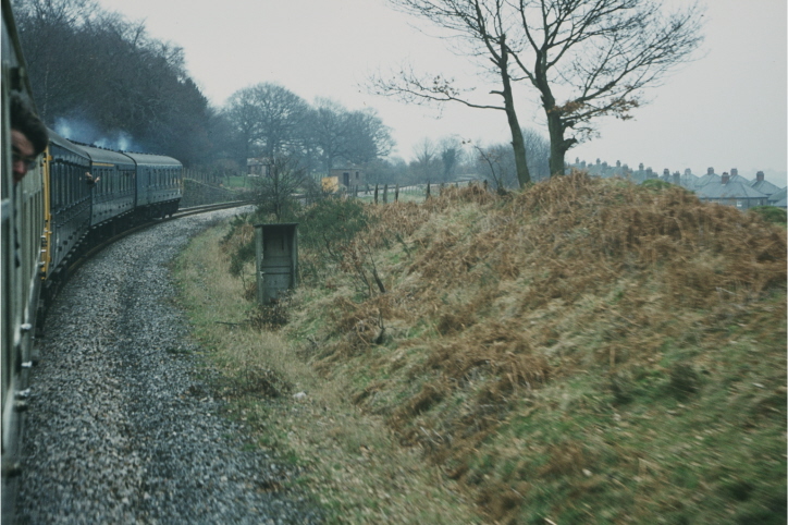
The exhausts continue to rasp as the train continues its journey towards Pentrepiod Halt, having almost completed the 270 degree bend of the horseshoe. The brick hut in the distance still stands, though there is now no sign of the hut in the foreground. The houses on the right belong to a small estate of houses built by the local authority called Waunddu. |
|
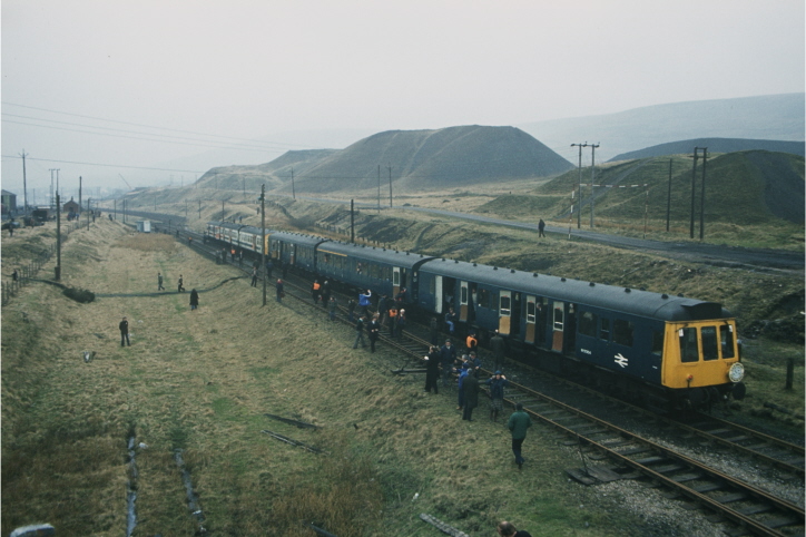
The train comes to rest at the exchange sidings, which are just below the current level crossing at Furnace Sidings. The set nearest the camera is Met-Camm Class 101, set no. B803, whilst the far set is a BRCW Class 118, set no. B462. The far car, 51304, suffered the indignity of being the first Class 118 car to be scrapped. The end came in 1985. Beyond the train is a footbridge – the abutments, now truncated, remain, just south of the level crossing, which was laid in some years later. How useful this bridge would be today! Note the lack of vegetation, largely kept in check by large numbers of foraging sheep |
|
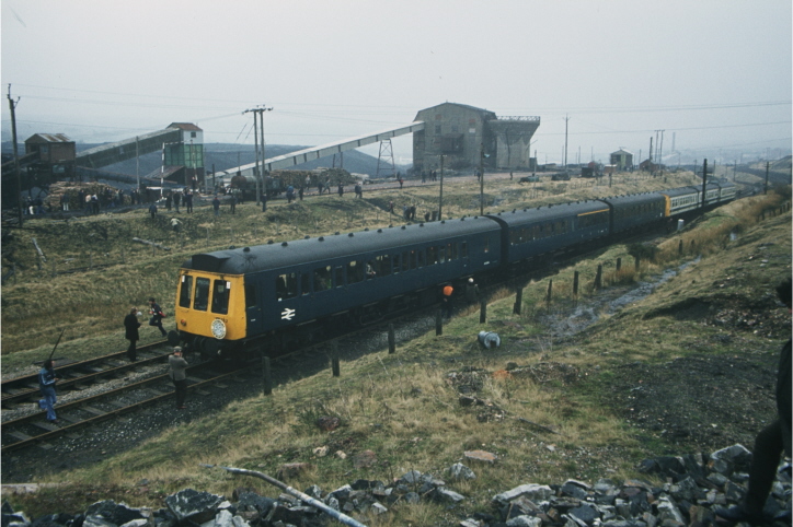
A view looking south east down the train towards the rail over rail bridge, from the bridge seen earlier. On the extreme left, a corner of the bottom shed is just peeping into the scene. The brick hut to its right has now gone. The foreground area to the left of the train is now largely occupied by the ‘deviation’ - the line by which stock leaves our yard for the main line. The biggest slag heap is Coity Tip. The road coming in from the right is the link road to Big Pit – this was once a railway line. Just beyond the last coach of the train can be seen the western outside sidings which were lifted in the mid-eighties – perhaps we will see them relaid one day. |
|
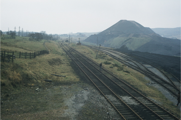
A view from the other end of the bridge looking across the yard. The water tower provides a perfect key to the location but the washery building and its associated towers and conveyor systems were all removed in the mid-eighties. The areas immediately above the first coach is now occupied by the top shed, whilst above the fourth coach, a chimney of Daniel Doncaster’s works can be seen dimly in the distance. Note how widely distributed are electricity supplies, which are distributed around the area using wooden poles. |
|
Perhaps the most fascinating image in the collection, this view depicts what was for almost 30 years, the operable part of the PBR. The gentleman without the hi-viz vest is walking alongside the now Furnace Sidings platform, whilst the level crossing is in the immediate foreground. At the top of the loop, the headshunt is now absent. In the right foreground the fan of sidings is now the paddock behind the platform, whilst beyond them two massive tips have now been removed to be replaced by the Garn Lakes. In the distance to the immediate left of the tips is Cooper’s Metal Reclamation works, with the Whistle bridge and Inn can also be seen. The brick platelayers hut survives, but the sleeper built hut in the distance has now gone. Peeping from behind some trees is the historic Ty Rheinallt farm. What a pity the overbearing planning laws have mitigated against any reconstruction of this important seventeenth century farmstead, which is now almost certainly beyond redemption. |
This site and all its contents are (c) Pontypool and Blaenavon Railway (1983) Ltd.
No part of this site may be copied or used without permission.